
Collegiate emergency medical service (EMS) agencies provide valuable services to college and university campuses across the United States through quick response times and peer-to-peer assistance. However, the unique layout and road network of a college campus can provide unique challenges, such as limited vehicle access to inner campus and indirect routes to high volume call areas. Geospatial analysis of the St. Lawrence University campus in Canton, NY was used to gain a better understanding of the impact of these factors on the response time of St. Lawrence University Emergency Medical Services (SLU EMS).
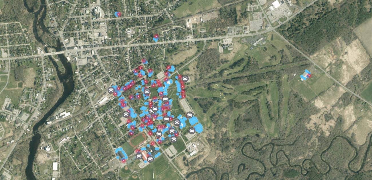
GPS points were acquired at every entrance to buildings on the main campus, using an EOS Arrow 100 mobile GPS unit and the Esri Field Maps app on an iPhone 13. This data collection was performed in a feature layer designed in ArcGIS Online. Other feature layer datasets, used to account for the designated parking locations of the SLU EMS response vehicle, were created within ArcGIS Online. All datasets were migrated into ArcGIS Pro for spatial analysis. Data will be combined with pre-existing roadway feature layers to analyze routes through the campus with the lowest travel times.
The entrances dataset contains 406 collected GPS points. Within the two feature layers for vehicle locations, 62 points were created. High call volume areas of campus were determined by assessment of SLU EMS call records (2,126 calls) in the period between August 2014 and May 2023. The data was entered into Excel and transferred into ArcGIS Pro. Spatial analysis was then performed to determine areas of high volume.
Preliminary results suggest that the fixed gates on the north end of campus may increase response times. Further data processing will provide more insight as to the extent of this effect. Future work may consider additional factors such as travel on foot as well as by vehicle when delineating the most efficient response routes.